Central Atlantic Ocean
Click the chart to enlarge 10X
Full size image = 201 kb

| Ocean-Pro Weather Routing for Yachts Globally | Official Maptech Chart Source Affiliate Member | |
| Personalized Weather Forecasting & Weather Routing for Yachts, Power & Sail | ||
| | Home | Site
Index
| Global Satellite Weather | Global
Weather & Services | Global Tropical Weather | Ocean
Currents & Gulf Stream | | Global Weather Routing | Offshore Communications | Global Buoy Data | International Charts | US Charts | Contact | Capt Bob | |
||
| IHO International Charts for the No & So Atlantic, No & So Pacific and the Indian Ocean | ||
Click each chart to enlarge the chart about 10x.
| Chart IHO INT 12 Central Atlantic Ocean Click the chart to enlarge 10X Full size image = 201 kb |
|
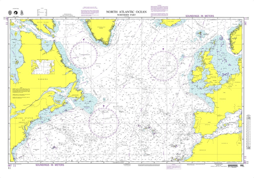
| Chart IHO INT 11 North Atlantic Ocean Click the chart to enlarge 10X Full size image = 253 kb |
 |
| Chart IHO INT 126 NE Atlantic, Gibraltar to Scotland Click the chart to enlarge 10X Full size image = 218 kb |
 |
| Chart IHO INT 310 Mediterranean Sea Click the chart to enlarge 10X Full size image = 500 kb |
 |
| Chart IHO INT 20 Western South Atlantic & So America Click the chart to enlarge 10X Full size image = 208 kb |
 |
| Chart IHO INT 21 Eastern South Atlantic & Western Africa Click the chart to enlarge 10X Full size image = 337 kb |
 |