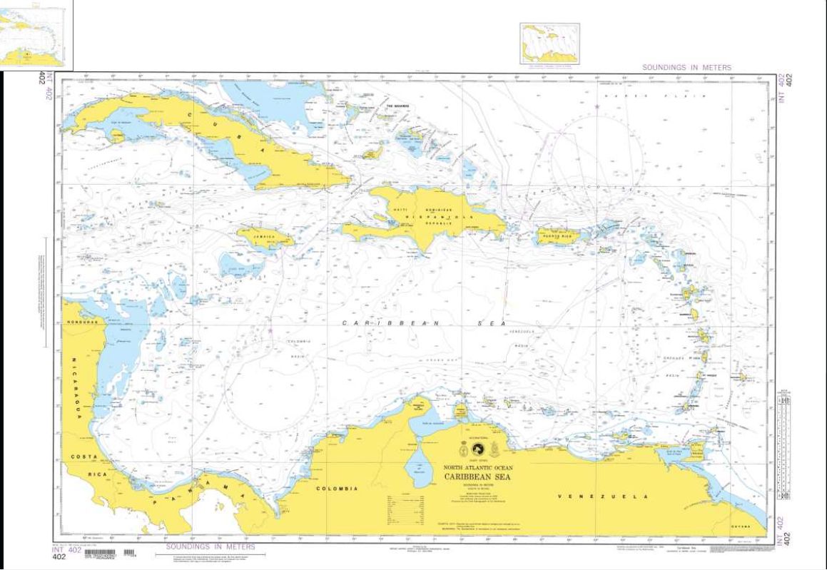
Click the chart to enlarge 10X
Full size image = 121 kb
| Ocean-Pro Weather Routing for Yachts Globally | Official Maptech Chart Source Affiliate Member | |
| Personalized Weather Forecasting & Weather Routing for Yachts, Power & Sail | ||
| | Home | Site
Index
| Global Satellite Weather | Global
Weather & Services | Global Tropical Weather | Ocean
Currents & Gulf Stream | | Global Weather Routing | Offshore Communications | Global Buoy Data | International Charts | US Charts | Contact | Capt Bob | |
||
| NOAA Charts of the Caribbean, Gulf of Mexico & US East Coast (Texas to Maine) | ||
Click on each chart to enlarge it about 10x.
| IHO chart 402, The Caribbea Sea Click the chart to enlarge 10X Full size image = 121 kb |
|
| NOAA chart 11013 Northwest Caribbean Click the chart to enlarge 20X Full size image = 863 kb |
 |
| NOAA chart 411 Gulf of Mexico Click the chart to enlarge 20X Full size image = 566 kb |
 |
| NOAA chart #13003 northeastern US Click the chart to enlarge 20X Full size image = 738 kb |
 |
| NOAA chart #11009 Southeastern US Click the chart to enlarge 20X Full size image = 735 kb |
 |
| NOAA chart 11006 Eastern Gulf of
Mexico Click the chart to enlarge 20X Full size image = 743 kb |
 |
| NOAA chart 25640 Puerto Rico Click the chart to enlarge 20X Full size image = 397 kb |
 |
| NOAA chart 25641 Virgin Islands Click the chart to enlarge 20X Full size image = 495 kb |
 |
| IHO chart 501 West Coast of North America Click the chart to enlarge 20x Full size image = 98 kb |
 |